
Another Trump Post, Another Diplomatic Backlash

Donald Trump’s latest map-making exercise has sparked a diplomatic backlash across the North Atlantic.

Maryam Tariq

Over the Labor Day weekend, the U.S. president posted an image on Truth Social showing a dramatically expanded United States. The map covered Canada, Mexico, Greenland, Iceland, Central America and parts of the Caribbean with the American flag, with the territory labelled “United States of America.” Trump provided no explanation or caption alongside the image.

The image itself is not a formal U.S. proposal to annex any of these territories. But it comes against the backdrop of Trump’s repeated comments about expanding American territory and influence.

Trump has repeatedly floated the idea of making Canada the 51st U.S. state and has pushed for the United States to acquire Greenland, an autonomous territory within the Kingdom of Denmark. Both ideas have been rejected by the governments and populations concerned.
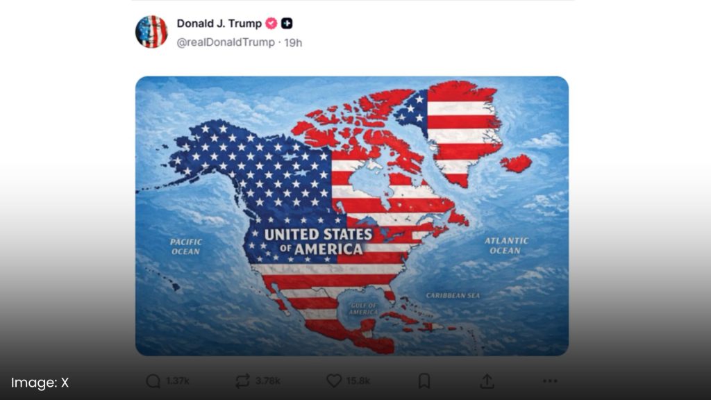
The inclusion of Iceland, however, added another layer to the controversy.

On Tuesday, Iceland’s Foreign Minister Þorgerður Katrín Gunnarsdóttir summoned U.S. Ambassador Billy Long to convey that the post was “completely inappropriate.” Icelandic officials have previously faced controversy over remarks about the country becoming a U.S. state, including a joke by Long about Iceland becoming the 52nd state.

Iceland is also a NATO member and has a longstanding defense relationship with the United States, making the episode particularly awkward for two countries that remain security partners.

Denmark also reacted sharply.

Foreign Minister Lars Løkke Rasmussen described the map as “disturbing” and “completely inappropriate,” saying it appeared to reflect what he called a “maximalist vision” that allies need to rein in. Greenland’s status makes the issue especially sensitive: it governs itself in many areas but remains part of the Kingdom of Denmark.

The latest controversy follows a series of Trump statements and symbolic actions involving neighboring countries and geographic territory. His administration has pushed the use of “Gulf of America” instead of Gulf of Mexico in federal contexts, while Trump has also promoted other proposed geographic renamings.

For Canada’s government, the issue comes amid already strained relations with Washington over trade. For Greenland and Denmark, it comes after months of public debate over Trump’s interest in bringing Greenland under U.S. control.

That is why the map has caused more than just an internet stir.

A social media image does not change borders, and there is no indication that the map itself represents a new U.S. policy. But when the person posting it is the president of the world’s most powerful country, and has repeatedly spoken about acquiring territory belonging to allies, even a seemingly provocative image can carry diplomatic weight.

For Iceland, Denmark and other U.S. partners, the question is increasingly not whether the map can literally redraw borders.

It’s how seriously they should take the rhetoric behind it.

Sources:

Associated Press | Reuters | RÚV | Icelandic Ministry of Foreign Affairs

Donald Trump’s latest map-making exercise has sparked a diplomatic backlash across the North Atlantic.

Maryam Tariq

Over the Labor Day weekend, the U.S. president posted an image on Truth Social showing a dramatically expanded United States. The map covered Canada, Mexico, Greenland, Iceland, Central America and parts of the Caribbean with the American flag, with the territory labelled “United States of America.” Trump provided no explanation or caption alongside the image.

The image itself is not a formal U.S. proposal to annex any of these territories. But it comes against the backdrop of Trump’s repeated comments about expanding American territory and influence.

Trump has repeatedly floated the idea of making Canada the 51st U.S. state and has pushed for the United States to acquire Greenland, an autonomous territory within the Kingdom of Denmark. Both ideas have been rejected by the governments and populations concerned.

The inclusion of Iceland, however, added another layer to the controversy.

On Tuesday, Iceland’s Foreign Minister Þorgerður Katrín Gunnarsdóttir summoned U.S. Ambassador Billy Long to convey that the post was “completely inappropriate.” Icelandic officials have previously faced controversy over remarks about the country becoming a U.S. state, including a joke by Long about Iceland becoming the 52nd state.

Iceland is also a NATO member and has a longstanding defense relationship with the United States, making the episode particularly awkward for two countries that remain security partners.

Denmark also reacted sharply.

Foreign Minister Lars Løkke Rasmussen described the map as “disturbing” and “completely inappropriate,” saying it appeared to reflect what he called a “maximalist vision” that allies need to rein in. Greenland’s status makes the issue especially sensitive: it governs itself in many areas but remains part of the Kingdom of Denmark.

The latest controversy follows a series of Trump statements and symbolic actions involving neighboring countries and geographic territory. His administration has pushed the use of “Gulf of America” instead of Gulf of Mexico in federal contexts, while Trump has also promoted other proposed geographic renamings.

For Canada’s government, the issue comes amid already strained relations with Washington over trade. For Greenland and Denmark, it comes after months of public debate over Trump’s interest in bringing Greenland under U.S. control.

That is why the map has caused more than just an internet stir.
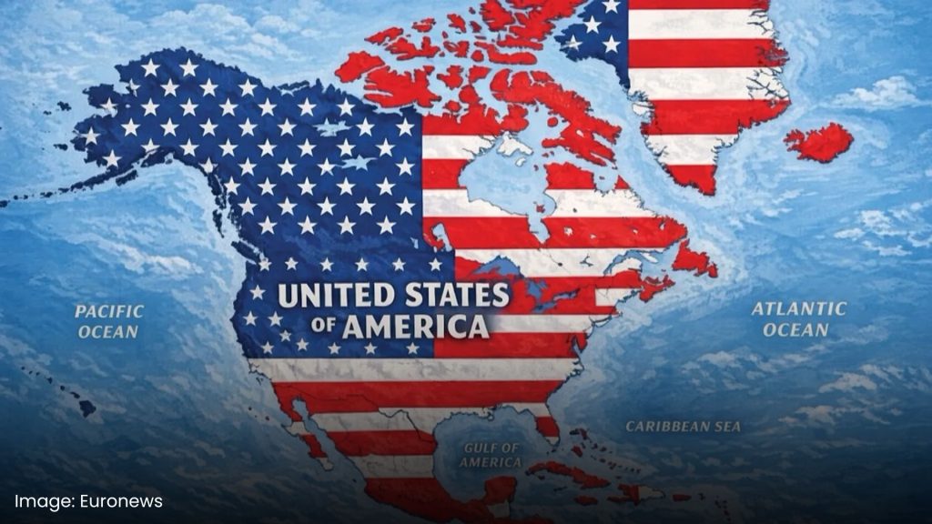
A social media image does not change borders, and there is no indication that the map itself represents a new U.S. policy. But when the person posting it is the president of the world’s most powerful country, and has repeatedly spoken about acquiring territory belonging to allies, even a seemingly provocative image can carry diplomatic weight.

For Iceland, Denmark and other U.S. partners, the question is increasingly not whether the map can literally redraw borders.

It’s how seriously they should take the rhetoric behind it.

Sources:

Associated Press | Reuters | RÚV | Icelandic Ministry of Foreign Affairs

spot_img

Explore more

spot_img
Global Affairs

Europe’s “Toughest Ever” Migration Crackdown Is Arriving

Who Was Ratko Mladić OR Why Are Thousands Celebrating a Convicted...

A French MP Used AI to Strip a Real Woman’s Hijab...

Chinese Nationals Smuggled Human Tissue Out of Pakistani Hospitals to Sell...

History Is Repeating. A Cold War Soviet Playbook Is Running Across...

Germany’s Power Grid Attacks Fit a Pattern Tied to Ukraine Support

Is the US-Venezuela Oil Deal Really About Gas Prices, or a...

How Ratko Mladic Personally Ignited and Directed the Bosnian Genocide